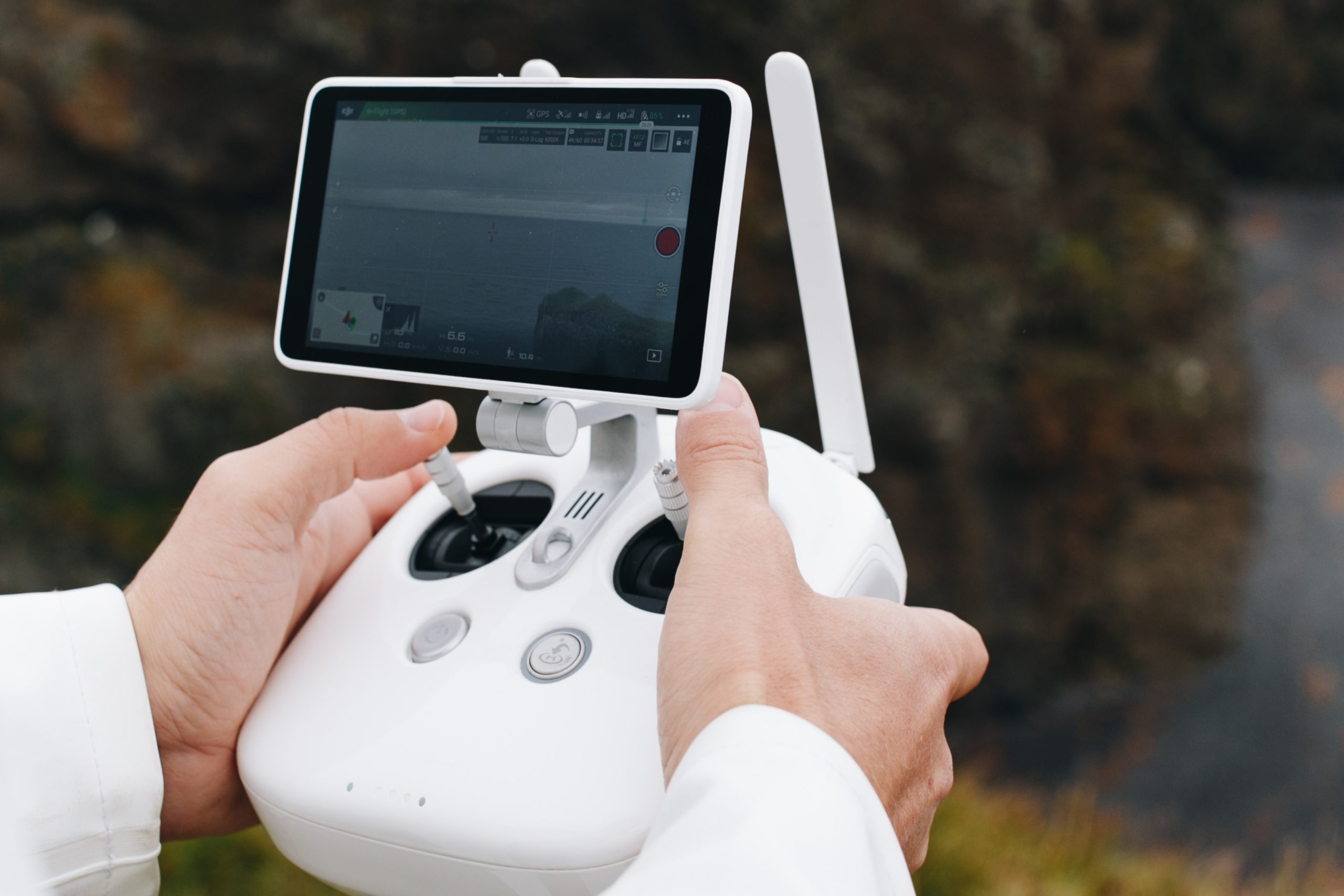
Are you curious about the in-demand drone pilot jobs for 2024? If you’re nodding your head, you’re in for a treat! In this article, we’ll explore the most promising opportunities for drone operators this year and how you can take the first steps toward landing your dream job. The global drone market is thriving, with projections estimating it will reach $54.6 billion by 2030. This rapid growth is creating a wealth of opportunities for drone pilots. To kick things off, let’s start with the basics of drone pilot roles.
What Does a Drone Pilot Do?
Think of a drone pilot as the captain of a small flying machine. Their role is to ensure this high-tech aircraft takes off, navigates safely through the skies, and lands smoothly. Here’s a closer look at what they typically do:
1. Fly Safe
Just like airline pilots, drone pilots prioritize safety by conducting thorough aircraft checks before each flight. This pre-flight inspection includes scrutinizing the drone’s hardware, battery levels, camera functionality, and any additional equipment required for the mission. Ensuring that everything is in top condition is essential for avoiding mid-flight issues.
Safety planning extends beyond just the pre-flight checklist. Drone pilots meticulously map out their flight paths, considering any potential obstacles such as buildings, trees, or restricted airspace. They also familiarize themselves with local regulations, ensuring compliance with any air traffic control guidelines or no-fly zones. This proactive approach minimizes risks and ensures a smooth journey.
During the mission, drone pilots maintain constant vigilance, actively monitoring their surroundings to avoid potential collisions with other aircraft or obstacles. This situational awareness is crucial, as it allows them to navigate effectively and respond to any unexpected challenges in real-time. For instance, if another drone unexpectedly enters their airspace, a skilled pilot must quickly decide whether to adjust their altitude or change direction to ensure safety.
Additionally, many drone pilots utilize software applications that provide real-time data on weather conditions, air traffic, and other variables that could impact their flight. By keeping abreast of these factors, they can make informed decisions and alter their plans as necessary.
2. Taking Great Pictures and Videos (or Other Cool Stuff)
Many drone pilots leverage their skills to capture breathtaking visuals that tell a story or provide valuable data. This role can vary significantly, encompassing everything from stunning aerial shots for movies to collecting crucial information for construction sites. In this way, drone pilots often act as flying cameramen or data collectors, showcasing the versatility of their craft.
When it comes to photography and videography, pilots are responsible for operating the camera mounted on their drones. This requires not only technical knowledge of the drone’s controls but also an artistic eye to capture the perfect shot. For example, when filming for a movie, a drone pilot may need to execute precise maneuvers to achieve dynamic angles and smooth movements, ensuring the visuals are cinematic and engaging.
In the real estate sector, drone pilots can provide aerial views of properties, giving potential buyers a unique perspective that traditional photography cannot match. These sweeping shots highlight the property’s surroundings, features, and layout, making listings more attractive and informative. The ability to capture high-quality images from above can significantly enhance marketing efforts.
Beyond photography, drones are invaluable tools for data collection in various industries. In construction, drone pilots can survey sites, monitor progress, and inspect hard-to-reach areas, all while generating detailed maps and models. This data is crucial for project planning, safety assessments, and ensuring compliance with regulations. By delivering real-time information, drone pilots help teams make informed decisions and stay on schedule.
Additionally, drone pilots often employ creative techniques, such as time-lapse photography or hyper-lapse videos, to create visually compelling content that showcases change over time. This approach can be particularly useful in agriculture, where drones can monitor crop health and growth patterns, providing farmers with insights to optimize their yields.
3. Planning the Adventure
Drone missions don’t happen accidentally; they require careful planning and consideration. Before pilots take to the skies, they do their homework to determine the best flight path for the task at hand. This involves a comprehensive assessment of various factors to ensure a successful mission.
One of the first steps is to research the area where the drone will be operated. Pilots must be aware of the terrain, any potential obstacles, and the specific objectives of their flight. For instance, if they’re capturing aerial footage for a film, they’ll want to identify the most visually appealing angles and landscapes. If they’re surveying a construction site, they’ll need to determine the best vantage points for data collection.
Weather conditions are another critical consideration. Drone pilots check forecasts to assess wind speed, precipitation, and visibility. Poor weather can affect drone performance and safety, making it crucial to choose a day with optimal flying conditions. Understanding how weather impacts flight dynamics helps pilots plan for potential challenges.
Furthermore, pilots must also be knowledgeable about airspace regulations. They need to know where they’re allowed to fly, as there are often restrictions in urban areas, near airports, or in sensitive environments. By consulting resources like aeronautical charts and local regulations, pilots can avoid legal issues and ensure a safe operation.
Another important aspect of planning is data analysis. After a flight, pilots often review the data collected to evaluate the effectiveness of their mission. This might involve analyzing aerial footage for quality or examining survey data for accuracy. By doing so, they can refine their techniques for future flights, improving their skills and the quality of their work.
How to Become a Drone Pilot
If you’re interested in becoming a commercial drone pilot, the first step is to obtain a license from your country’s regulatory body. In the United States, this is overseen by the Federal Aviation Administration (FAA) under their Part 107 Small Unmanned Aircraft System (sUAS) Rule. This license certifies that you have the necessary knowledge and skills to operate drones safely and responsibly while adhering to airspace regulations.
Eligibility Requirements
Before you can begin the licensing process, there are a few eligibility criteria you must meet:
Age: You need to be at least 16 years old.
Background Check: You will undergo a background check to ensure safety compliance.
Language Proficiency: You must be able to read, speak, understand, and write in English fluently.
The Testing Process
Once you meet the eligibility requirements, the next step is to pass an aeronautical knowledge exam, which is offered at FAA-approved testing centers. Here’s what you need to know about the testing process:
Exam Content: The exam covers essential topics, including airspace regulations, drone safety protocols, and emergency procedures. Familiarizing yourself with these subjects is crucial for success.
Study Materials: Numerous resources are available to help you prepare for the exam. The FAA website offers official study guides and sample questions, while various third-party providers also provide courses, videos, and practice tests to reinforce your knowledge.
Scheduling the Exam: After you feel prepared, you can schedule your exam at a designated testing center. The test typically consists of multiple-choice questions, and you’ll need to achieve a passing score to earn your certification.
Additional Steps to Enhance Your Skills
After obtaining your license, consider pursuing additional training or certifications to enhance your skills and marketability as a drone pilot. Here are some options:
Advanced Certifications: Depending on your interests, you might explore specialized certifications in areas like aerial photography, surveying, or thermal imaging. These credentials can help you stand out in a competitive job market.
Hands-On Experience: Practice is vital. Gain experience by flying drones in various conditions and for different applications. This hands-on experience will not only build your confidence but also improve your technical skills.
Networking: Join drone pilot communities, attend industry events, or participate in online forums. Networking can provide valuable insights and opportunities for collaboration, helping you grow professionally.
What Are Some Drone Pilot Jobs?
The world of drone pilot jobs is incredibly varied, offering exciting opportunities across multiple industries. Here are some of the most in-demand positions you might consider:
1. Drone Jobs in Real Estate
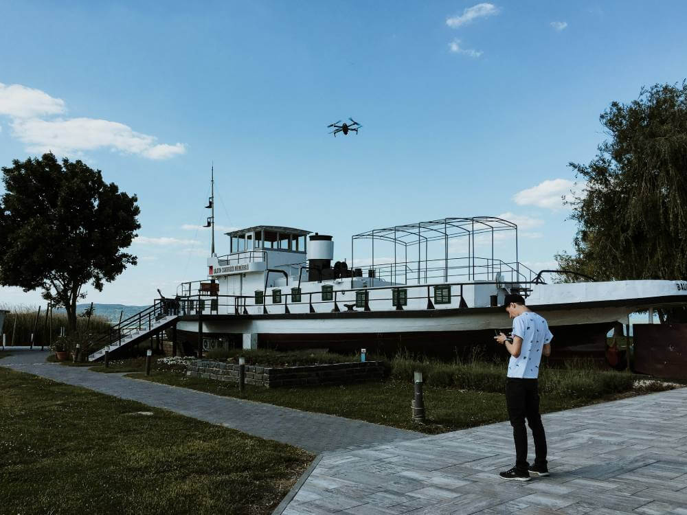
The real estate sector is one of the most dynamic fields for drone pilots, primarily focusing on enhancing property listings with stunning aerial visuals. As a real estate drone pilot, your role is pivotal in helping realtors and property owners present their listings in the best light.
Capturing Aerial Imagery
Drones provide a unique perspective that traditional photography simply cannot match. The ability to capture breathtaking aerial stills and videos showcases the property itself and highlights its surrounding landscape, amenities, and accessibility. This immersive visual content can make a significant impact in attracting potential buyers. In my opinion, there’s something truly magical about seeing a property from the sky—it can transform a standard listing into an enticing visual story.
Marketing Advantage
In a competitive market, having high-quality aerial imagery can set a property apart. Real estate agents often rely on eye-catching visuals to create compelling marketing materials, including online listings, brochures, and promotional videos. Your skills as a drone pilot can provide them with the edge they need to stand out. I believe this is where drone pilots really shine—being able to turn a mundane listing into a captivating experience is a powerful tool in today’s digital marketplace.
Building a Portfolio
To succeed in this niche, building a robust portfolio is essential. Showcase your best work to demonstrate your ability to capture smooth, high-quality footage. Consider offering introductory services or collaborating with local realtors to gain experience and expand your network. I think having a diverse portfolio not only showcases your technical skills but also your creative vision, which can be incredibly appealing to potential clients.
Skills and Equipment
To excel in this role, you’ll need to master drone piloting and photography skills. Understanding lighting, composition, and video editing will significantly enhance the quality of your work. Investing in a good drone equipped with a high-resolution camera will also ensure you can deliver professional results. From my perspective, the right equipment can elevate your work significantly—it’s worth the investment if you’re serious about pursuing this career.
Networking with Realtors
Connecting with real estate agents and agencies is crucial. Attend local real estate events, join online forums, and leverage social media platforms to build relationships. Realtors often seek reliable drone pilots who can deliver consistent results, making networking an essential part of your strategy. I find that building these relationships can be just as important as technical skills—personal connections often lead to opportunities that you wouldn’t find otherwise.
Merits and Demerits of Choosing the Real Estate Industry
Choosing to become a drone pilot in the real estate industry comes with its own set of advantages and challenges. Here’s a breakdown of the merits and demerits to consider:
Merits
High Demand for Aerial Footage: There’s a growing need for aerial photography and videography in real estate marketing. Properties are being showcased innovatively, and drone pilots play a crucial role in capturing those stunning visuals that grab buyers’ attention.
Flexible Work Schedule: Many drone pilots enjoy the flexibility of freelance work. You can set your own hours and take on projects that fit your schedule, making it easier to balance personal and professional commitments.
Unique Perspectives: Drones offer the ability to capture unique angles and perspectives that traditional photography simply can’t match. This capability can help showcase properties more effectively, making listings more appealing to potential buyers.
Outdoor Work Environment: If you enjoy being outside, this job allows you to explore various properties and locations. From stunning landscapes to urban settings, every job can offer a different experience, keeping the work exciting.
Demerits
Stringent Regulations: Operating drones come with strict regulations and licensing requirements, which can vary by region. This can be a hurdle for those just starting out, as it involves understanding the rules and ensuring compliance.
Weather Limitations: Weather conditions can significantly impact flight operations. Rain, wind, or extreme temperatures can limit your shooting ability, potentially affecting your productivity and income.
Initial Investment: High-quality drones and equipment can require a substantial upfront investment. While this can lead to higher-quality work, it’s essential to consider the financial commitment involved.
Competition: The increasing popularity of drones in real estate means more competition in the market. Standing out among other drone pilots and aerial photography services can be challenging and may require continual skill development and marketing efforts.
Versatility of Drone Work in Real Estate
Drone pilots in the real estate sector have the advantage of engaging in diverse projects. This versatility keeps the work interesting and allows for the development of various skills and techniques that can enhance a pilot’s portfolio. Here are some common missions that UAV pilots typically undertake:
Diverse Project Opportunities
Property Listings: Perhaps the most common task is capturing stunning aerial shots of residential properties for listings. These visuals help real estate agents showcase the property’s surroundings and layout, making it more appealing to potential buyers.
Commercial Complexes and Shopping Centers: Drones are increasingly used to document commercial properties, providing sweeping views highlighting key features, parking spaces, and access points. This can be a game-changer in attracting businesses and investors.
Resort Facilities: For resorts and hotels, drone photography can capture the beauty of the landscape, pool areas, and amenities from unique angles. These images can enhance marketing materials, making the properties more enticing to vacationers.
Golf Courses: Golf courses can be particularly stunning from above, showcasing their layout, water features, and surrounding scenery. Drones provide an opportunity to create promotional videos or promotional materials that truly capture the essence of these leisure spaces.
Benefits of Versatility
The versatility of drone work allows pilots to:
Expand Skill Sets: Working on various projects helps pilots develop different filming techniques, editing skills, and even data analysis capabilities.
Build a Diverse Portfolio: Engaging in a wide range of missions allows pilots to showcase their versatility to potential clients, making them more attractive in a competitive market.
Networking Opportunities: Each project offers the chance to meet new clients and industry professionals, which can lead to more job opportunities down the line.
Continuous Learning: Each project’s different requirements and challenges can contribute to ongoing personal and professional growth.
2. Drone Jobs in Construction
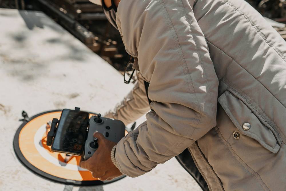
The construction industry is rapidly embracing drone technology, marking it as one of the fastest-growing sectors for commercial UAV (unmanned aerial vehicle) operators. The exponential growth in drone usage is not only a trend but a transformative shift aimed at enhancing efficiency and reducing costs.
Why Drones are Becoming Essential in Construction
According to market research, the drone market is projected to grow at a compound annual growth rate (CAGR) of 23.4%, potentially reaching a value of $9.376 billion by 2033. This growth is driven mainly by the construction sector, where traditional projects often run significantly behind schedule—averaging a 20-month delay and inflating costs by nearly 80%.
Drones are proving to be invaluable tools in mitigating these challenges by conducting essential surveys throughout the construction lifecycle, which include:
Precise Measurement and Location of Stockpiles: Drones provide accurate data on material volumes and locations, eliminating the need for manual surveys and reducing potential errors. This capability allows for better inventory management and planning.
Real-Time Progress Monitoring in Remote Areas: Drones can easily access hard-to-reach locations, such as mountains or deserts, offering a safe and efficient way to track construction progress. This real-time monitoring helps project managers stay on schedule.
Enhanced Safety Assessments: By inspecting dangerous or difficult-to-access areas, drones identify potential hazards and ensure worker safety. This proactive approach to safety is crucial in minimizing accidents on job sites.
Exciting Opportunities for UAV Operators
The growing use of drones in construction has opened up a variety of job opportunities for UAV operators. Here are some key roles:
Site Selection: Drone pilots can provide updated aerial views of prospective sites, aiding in the selection and planning processes. This data is invaluable for making informed decisions.
Zoning Meetings: By delivering drone-collected data to zoning boards, UAV operators can expedite zoning meetings, thereby reducing delays that can derail projects
Legal Protection and Documentation: Drones can document site conditions by creating maps or videos, providing a record of the area before heavy equipment arrives. This documentation helps construction teams prepare effectively.
Construction Monitoring and Management: Operators can generate high-resolution maps of job sites, allowing contractors to monitor and manage construction sites more effectively. This oversight ensures projects remain on track and within budget.
Construction Progression: Drones allow for the importation of updated site plans, enabling comparisons between designs and actual construction in both 2D and 3D. This feature helps track progress accurately and keeps stakeholders informed.
In my opinion, the integration of drones in the construction industry represents a game-changing opportunity for both companies and UAV operators. The ability to conduct precise surveys, monitor progress, and enhance safety not only saves time and money but also promotes a more efficient work environment.
Merits
Enhanced Project Monitoring: Drones facilitate aerial surveys and inspections, allowing for real-time progress tracking.
Improved Safety: Remote monitoring reduces the need for on-site visits, minimizing risk to personnel.
Efficient Data Collection: Drones enable accurate site mapping, topography analysis, and the creation of detailed 3D models.
Quick Issue Identification: Drones can rapidly spot potential problems like structural defects or safety hazards.
Demerits
Regulatory Challenges: Navigating complex airspace regulations and restrictions around construction sites can be difficult.
Cost Concerns: There are significant initial investment and ongoing maintenance costs for high-quality drone equipment.
Battery Limitations: Drones have limited battery life and flight time, which can affect productivity and the amount of data collected.
Weather Dependency: Drone operations rely highly on favorable weather conditions, which can impact scheduling and effectiveness.
Drone Work in the Construction Industry
UAV pilots in the construction industry perform a variety of missions that are crucial for project success. These missions often include:
Pre-Building Site Inspections: Pilots assess the site to evaluate the terrain, identify potential drainage issues, and consider other environmental factors. This data helps determine the best locations for building, excavation, or stockpiling materials, ultimately leading to more efficient project planning.
Site Mapping and Surveying: Drones are equipped with advanced imaging technology to create detailed topographic maps. This information is vital for project planning, allowing teams to visualize the site and make informed decisions about layout and design.
Progress Monitoring: Regular aerial surveys help track construction progress against timelines and budgets. UAVs can capture high-resolution images and videos, enabling project managers to identify any delays or issues early on.
Safety Inspections: Drones can quickly assess hard-to-reach areas of a construction site, such as rooftops or elevated structures, reducing the need for workers to perform risky inspections. This enhances overall site safety and compliance with regulations.
Data Collection for 3D Modeling: Drones can gather data that is then processed into 3D models, which can be used for simulations, visualizations, and further planning. This technology helps streamline communication among stakeholders and enhances project accuracy.
Skills and Qualifications
To be successful in this role, UAV pilots must possess several essential skills:
Technical Proficiency: A solid understanding of drone operation, software for data processing, and the specific equipment used in construction-related missions is essential.
Regulatory Knowledge: Familiarity with local and national regulations governing drone operations is crucial. Pilots must ensure compliance to avoid legal issues.
Attention to Detail: The ability to spot discrepancies or potential hazards during flights is vital for maintaining safety and project integrity.
Communication Skills: UAV pilots often collaborate with engineers, architects, and construction managers, making effective communication essential for conveying findings and recommendations.
Career Opportunities
The demand for UAV pilots in the construction industry continues to grow, driven by the increasing adoption of drone technology. Whether you’re working for a large corporation or a small startup, opportunities abound:
Construction Companies: Many firms are integrating drone technology into their workflows, seeking pilots who can enhance project efficiency and safety.
Consulting Firms: Some pilots work as independent contractors or consultants, providing specialized drone services to various construction projects.
Training and Education: With the growing popularity of drones, there is also a need for training programs, creating opportunities for experienced pilots to educate newcomers.
3. Drone Jobs in Mining and Aggregate
Mining and aggregate companies are rapidly embracing the capabilities of drones, recognizing their potential to enhance operational efficiency and safety. Here’s how drones are transforming these industries:
Applications in Mining
Mapping and Surveying: Drones are invaluable for creating detailed maps of mining sites. They can generate 3D models that help companies identify optimal locations for digging and stockpiling materials. This data supports better planning and resource allocation.
Safety Inspections: Drones can conduct safety inspections of mining operations, particularly in areas that may be hazardous for personnel. By using aerial imagery, companies can assess conditions without putting workers at risk.
Environmental Monitoring: Drones can monitor environmental conditions around mining sites, helping firms comply with regulations and minimize their ecological footprint.
Applications in the Aggregate Industry
Stockpile Management: Drones provide accurate measurements of stockpile volumes, enabling better inventory management. This helps companies optimize their operations and reduce waste.
Progress Monitoring: Regular aerial surveys allow aggregate companies to track the progress of extraction and production. This real-time data aids in adjusting operations to meet project timelines and budgets.
Quality Control: Drones can be used to monitor the quality of extracted materials, ensuring that they meet industry standards. This helps prevent costly rework and maintains customer satisfaction.
Efficiency and Safety Benefits
One of the most significant advantages of using drones in these industries is their efficiency. A drone can collect extensive data in less than 20 minutes—data that would take a person hours to gather on foot. This not only accelerates project timelines but also allows for more frequent data collection, leading to better decision-making.
Moreover, drones significantly enhance workplace safety by eliminating the need for personnel to enter potentially hazardous areas. They allow companies to gather critical information without exposing workers to dangerous conditions, thereby reducing the risk of accidents and injuries.
Career Opportunities
The integration of drones into mining and aggregate operations is creating a range of job opportunities:
UAV Pilot Positions: Companies are hiring skilled pilots to operate drones for various applications, from mapping to inspections.
Data Analysts: There is a growing demand for professionals who can analyze the data collected by drones and translate it into actionable insights for mining and aggregate operations.
Consulting Services: Experienced drone operators may find opportunities in consulting, helping firms optimize their drone operations and integrate them into their workflows.
Maintenance and Repair Technicians: As drone usage increases, so does the need for technicians who can maintain and repair the equipment to ensure smooth operations.
Merits and Demerits of Choosing the Mining Industry for Drone Pilots
The mining and aggregates industry presents distinct opportunities and challenges for drone pilots. Here’s a breakdown of the merits and demerits of working in this sector:
Merits
Faster and Cost-Effective Mapping: Drones enable pilots to map and measure large areas quickly and at a lower cost than traditional methods.
Enhanced Safety: Drones can access dangerous locations, reducing the need for personnel to enter hazardous environments and thereby improving worker safety.
Improved Decision-Making: Aerial data helps mine managers better plan operations, track materials, and make informed decisions, enhancing overall efficiency.
Environmental Monitoring: Drones can assess the impact of mining activities on the land, helping companies adhere to environmental regulations and practices.
Cost Savings: Drones can be more economical than traditional surveying methods for inspections and measurements, leading to significant operational savings.
Demerits
Regulatory Challenges: Flying drones in mines often requires special permissions due to safety and regulatory considerations, which can complicate operations.
Investment in Durable Equipment: The harsh environments of mines and quarries necessitate the purchase of high-quality drones that can withstand harsh conditions and produce clear images.
Data Processing Skills Required: Successfully leveraging drone data goes beyond just flying the drone; pilots need expertise in converting aerial images and measurements into actionable insights.
Operational Difficulties: Mines can be dusty, noisy, and cluttered with obstacles, which may complicate drone operations and affect data quality.
Need for High-Quality Drones: To achieve reliable results, pilots must invest in advanced drone technology, which can be a significant financial commitment.
4. Drone Jobs in Public Safety
Drones are becoming indispensable tools for public safety officials, revolutionizing various operations such as search and rescue, firefighting, and disaster relief logistics. According to a study from Bard’s Center for the Study of the Drone, over 1,500 public safety organizations were using drones as of March 2020, a number that has nearly doubled since mid-2018. This growth reflects the increasing recognition of drones’ capabilities in enhancing public safety.
How Drones Are Making a Difference
On The Frontline
Search and Rescue: Drones are invaluable during search and rescue missions, allowing teams to scan vast areas quickly and efficiently. They can locate lost hikers, victims trapped in floods, or distressed individuals, significantly speeding up rescue operations.
Disaster Response: After natural disasters like hurricanes or floods, drones play a crucial role in delivering vital supplies, assessing damage, and providing real-time information to first responders. This capability helps teams make informed decisions about resource allocation and recovery efforts.
Wildlife Conservation: Drones are also used in wildlife conservation, where they monitor endangered species, track poachers, and protect fragile ecosystems. This application highlights the versatility of drones beyond traditional public safety roles.
Supporting Local Heroes
Law Enforcement: Drones enhance law enforcement capabilities by creating 3D maps that improve response times and assist in crisis evacuations. They provide aerial perspectives that help officers assess situations more effectively.
Fire Departments: Drones aid firefighters by offering real-time views of fire scenes, helping them locate victims and navigate danger zones. The creation of orthomosaic maps allows fire crews to plan safer rescues by identifying exit points in buildings and understanding the layout of structures.
Specialized Training and Skills
To pursue a career as a drone pilot in public safety, specialized training or certification programs are often necessary. Here are some essential skills and knowledge areas:
Drone Operation Proficiency: Familiarity with drone controls, flight techniques, and troubleshooting is crucial for safe and effective operations.
Technology and Regulations: Understanding the latest drone technologies, regulations, and compliance requirements is essential. This knowledge helps ensure that operations are conducted legally and safely.
Communication Skills: Strong communication is vital for coordinating with public safety teams, especially in high-pressure situations. Being able to relay information clearly and efficiently can save lives.
Safety Procedures: Pilots must be well-versed in safety protocols for flying drones in high-risk environments. This includes assessing conditions and making real-time decisions to mitigate risks.
Emotional and Financial Rewards
Working with drones in public safety can be both financially rewarding and emotionally fulfilling. The sense of purpose that comes from contributing to search and rescue missions or disaster response efforts can be incredibly gratifying. For many, the opportunity to make a tangible difference in their communities is what draws them to this field.
Merits and Demerits of Choosing the Public Safety Industry
Drones in the public safety sector offer significant advantages, enabling quick responses to emergencies, enhancing safety for rescue teams, and providing cost-effective solutions. However, there are also challenges that come with their use.
Merits
Efficient Disaster Assessment: Drones can conduct aerial surveys quickly, allowing responders to assess damage and prioritize efforts more effectively in disaster situations. This capability can make a substantial difference in how swiftly and effectively aid is delivered, potentially saving lives in critical moments.
Enhanced Situational Awareness: During law enforcement operations, drones provide real-time data and aerial views, improving overall situational awareness and helping ensure public safety. This added perspective can empower law enforcement to make better decisions on the ground, particularly in complex or dangerous situations.
Quick Deployment: Drones can be rapidly deployed to monitor large crowds, manage traffic, and ensure security at events. This speed can be critical during emergencies or large gatherings. I find this aspect particularly exciting; the ability to mobilize technology quickly in response to unfolding events is a game-changer for public safety professionals.
Demerits
Dependence on Weather Conditions: Drone operations can be significantly impacted by adverse weather conditions, such as storms or low visibility, which may hinder their effectiveness in urgent situations. I think this is a significant limitation that needs to be addressed. Finding ways to enhance drone resilience in various weather conditions could significantly expand their utility.
Training and Certification Requirements: Initial training and certification for drone operation can be time-consuming, potentially delaying the deployment of drone services in critical scenarios. While I understand the need for thorough training, streamlined programs or on-the-job training opportunities could help mitigate this challenge and get skilled operators into the field faster.
Privacy Concerns: The use of drones for surveillance raises privacy issues and can lead to challenges in public perception. Ensuring transparency and addressing concerns is crucial to gaining community trust. In my opinion, open communication with the public about how drones are used and the measures taken to protect privacy is essential. Building that trust can help communities see drones as valuable assets rather than intrusions.
5. Drone Jobs in Agriculture
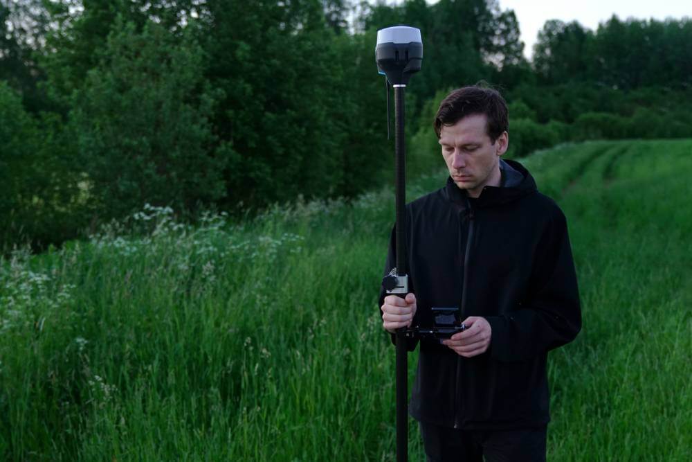
The agricultural industry is rapidly embracing drone technology, positioning it as one of the most promising markets for UAS (Unmanned Aerial System) operators. According to the Association for Unmanned Vehicle Systems International (AUVSI), agriculture is expected to be the largest market for drone applications in the coming years, creating ample opportunities for those equipped with the right skills and training.
Opportunities for Drone Pilots
As a drone pilot in agriculture, you have various career paths to explore:
Farm or Ranch Operator: Many farms and ranches are hiring drone operators to assist with daily operations. This role involves flying drones for tasks like crop monitoring, livestock tracking, and field analysis.
Consulting Services: You can provide consulting services to agricultural businesses, offering expertise on how to integrate drone technology into their operations. This can include training staff, advising on best practices, and helping with data analysis.
Entrepreneurial Ventures: If you’re entrepreneurial, starting your own drone-based business is a viable option. You could offer specialized services such as crop mapping, scouting, and monitoring, which are increasingly in demand as farmers seek innovative solutions to optimize their yields.
Key Skills and Tools
To succeed as a drone pilot in agriculture, familiarity with various software tools and data management resources is essential. Here are some key areas to focus on:
Data Analysis and Management: It is crucial to understand how to analyze and interpret data collected by drones. This includes creating NDVI (Normalized Difference Vegetation Index) maps, which help farmers identify plant health and distribution across their fields.
Technical Proficiency: Being skilled in operating drones, including navigating different terrains and weather conditions, is fundamental.
Decision-Making Abilities: Strong decision-making skills are necessary for identifying potential crop issues or hazards. The ability to quickly assess and act on data can make a significant difference in farm management.
The Impact of Drones on Agriculture
Drones are changing the way farmers manage their land. For instance, NDVI maps generated from drone imagery can provide insights into crop health, allowing farmers to make data-driven decisions about irrigation, fertilization, and pest management. This not only enhances productivity but also promotes sustainable farming practices by enabling targeted interventions.
Merits and Demerits of Choosing the Agriculture Industry for Drone Operators
Becoming a drone operator in the agriculture industry offers numerous advantages, but there are also challenges to consider. Here’s a breakdown of the merits and demerits:
Merits
Precision Agriculture: Drones provide aerial imagery that enables efficient crop monitoring and management. This precision helps farmers make informed decisions, enhancing productivity and sustainability.
Early Detection of Issues: Drones allow for the early detection of crop diseases, pest infestations, and nutrient deficiencies. Timely interventions can significantly mitigate losses and improve overall crop health.
Optimized Resource Utilization: By utilizing data-driven decision-making, drone operators can help farmers optimize resources like water, fertilizers, and pesticides, leading to increased yields and cost savings.
Improved Mapping and Analysis: Drones facilitate better mapping and analysis of field variability, enabling targeted treatments and precision spraying. This targeted approach can enhance efficiency and reduce waste.
Demerits
Cost of Investment: The initial investment in drone technology and training can be substantial, which may pose a barrier for small-scale farmers. This financial hurdle could limit access to advanced agricultural practices.
Limited Flight Time: Due to drones’ limited flight time and battery capacity, multiple flights may be required to cover large farm operations. This can be time-consuming and may complicate planning.
Complex Data Analysis: Analyzing and interpreting the data collected by drones can be complex and may require specialized knowledge or technical expertise. Farmers may need additional training or support to leverage this technology fully.
Integration Challenges: Integrating drone technology with existing farm management systems and workflows can be challenging. Disruptions in established practices may hinder the smooth adoption of drone solutions.
Types of Work in Agriculture That Involves Drone Technology
UAV (Unmanned Aerial Vehicle) operators in the agriculture industry engage in various missions that leverage drone technology to enhance farming practices. Here are some key applications:
Crop Scouting
Crop scouting involves flying drones over fields to identify potential issues or hazards. UAV operators can detect pest infestations, disease outbreaks, nutrient deficiencies, and signs of plant stress. By quickly assessing crop health, farmers can make timely interventions to mitigate risks and optimize yields.
Crop Mapping
Using drone imagery, operators can create detailed maps of crop health and performance. These maps provide valuable insights into field variability, helping farmers understand how different field areas perform. This information aids in land management decisions, allowing for more efficient resource allocation and ultimately improving yields.
Livestock Monitoring
Drones can be employed to monitor livestock activity and behavior. Operators can track grazing patterns, assess animal health, and identify signs of heat stress. This aerial perspective allows farmers to manage their herds more effectively and ensure that livestock are in optimal conditions.
Irrigation Monitoring
Drones equipped with thermal cameras can help identify irrigation concerns. They can pinpoint areas receiving too little or excessive water, helping farmers optimize their irrigation practices. This capability not only conserves water resources but also enhances crop health.
Soil and Field Analysis
Drone technology can be used to create 3D maps that detect soil quality, nutrient levels, and dead zones within fields. This data is invaluable for farmers, as it allows them to make informed decisions regarding planting patterns, water usage, and nutrient management. Understanding soil health is crucial for sustainable farming and maximizing crop productivity.
Personal Opinions
In my view, the diverse applications of drone technology in agriculture highlight its transformative potential. Each of these missions not only improves operational efficiency but also fosters a deeper understanding of farming practices. The ability to scout fields quickly, monitor livestock, and analyze soil quality can significantly impact a farmer’s bottom line and sustainability efforts.
As drone technology continues to evolve, we will see even more innovative applications emerge. This could lead to a future where data-driven decision-making becomes the norm in agriculture, ultimately enhancing food production and environmental stewardship. For anyone considering a career in this field, the opportunities are not only exciting but also crucial for the future of farming.


